K
Kathleen Martin
Guest
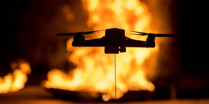
It’s common knowledge that fires are now a recurring and increasingly frequent calamity in many states and countries around the world – California being particularly vulnerable. Mindful of that, a San Francisco startup is attracting customers and investors alike with its drone- and tech-based service to map homes as the first step in maximizing their protection from wildfires.
Using drones to protect homes from spiking wildfire threat
Founded a mere six months ago, Firemaps is a fast-moving, rapidly growing company that uses drones and satellite imagery to create maps of clients’ homes. Its computerized analyses of the structures and surrounding terrain then proposes a range of “hardening” improvements – that is, measures that protect houses should wildfire come near. How rapidly does Firemaps act? It can have an accurate property map completed – down to the nearest centimeter – within 20 minutes of getting its drone aloft. Once potential hardening work is selected and agreed to by customers, Firemaps immediately sends bids to a variety of contractors on the company’s marketplace who are ready to begin work.
Why all the rush? In part because Firemaps is clearly a business with a vision, and a strong drive to bring it into reality. But it’s also because the company has found a way to marry cutting-edge tech with an increasingly urgent service that helps millions of potential clients protect their houses and lives. There isn’t a lot of time to waste in all that.
At the time of writing, there were 88 major blazes raging across 2.4 million acres within the US alone – most in Western states. Over the past decade, fully 90% of the country’s largest infernos occurred in California, at times wiping entire communities from the map, and incinerating countless billions of dollars in private and public property. A June study by a nonpartisan think tank estimated that around 8% of all homes in California are in high-risk wildfire zones. Since 2015, meanwhile, over 950,000 households in the state have been dropped by insurers as being inordinately high fire risks (let us spare a kind thought for the little corporate dears).
Against those diverse, growing threats, it’s little wonder people are turning to Firemaps and its fleet of drones for protection of their homes from wildfire risks. That, in turn, explains why Firemaps has already raised $5.5 million in seed funding from investors that include Andreessen Horowitz and Uber CEO Dara Khosrowshahi, among others.
Taking business prospecting lemons to launch a lemonade dynamo
Firemaps was founded by Silicon Valley entrepreneur Jahan Khanna and his brother, who after having earlier launched a ridesharing business turned to activities focusing on climate change. They eventually researched founding a solar power farm, only to be told developing large properties in California had become an iffy prospect due to the risk that they might all go up in flames. Realizing millions of homeowners and other real estate investors were already facing that fire threat, the brothers looked into the fastest, most efficient ways of helping people reduce that hazard through hardening.
Enter tech-toting drones to quickly map the lay of the land and propose improvements, stage right.
Continue reading: https://dronedj.com/2021/08/30/sf-startup-uses-drones-tech-to-maximize-home-protection-from-wildfires/